.png)
<\/p>\n
The Brushy Creek regional trail is a testament to Williamson County’s dedication to providing accessible recreation to the area.<\/p>\n
The Creek apartments give direct access to Brushy Creek Regional Trail. Located in Round Rock near the Play for All Abilities Park, our residents enjoy jogging, biking, and walking along the trail all year long.<\/p>\n
This is our guide to the Brushy Creek Regional Trail, including both the western segment in Cedar Park, and the eastern segment in Round Rock.<\/p>\n
<\/p>\n
History of Brushy Creek Trail<\/h2>\n
Brushy Creek is a 69-mile-long tributary of the San Gabriel River, running east through Central Texas. <\/p>\n
The Brushy Creek Regional Trail was established starting in 2001 in efforts for a connected trail extending from Cedar Park to Milam County. The plan was awarded a grant from Texas Parks and Wildlife Department for this regional trail in 2000.<\/p>\n
What started off as a short 2.5-mile trail composed of crushed rock located west of the I-35 highway has turned into a series of trailheads that expands just over 12 miles today.<\/p>\n
The western segment of Brushy Creek Regional Trail started construction in 2001 in partnership of TPWD, Williamson County, City of Austin, Fern Bluff and Brushy Creek MUDS, and two private ranches. It extended from Brushy Creek Lake Park to S. Great Oaks Drive.<\/p>\n
In 2003, the route expanded a mile east to Round Rock’s Creek Bend Boulevard.<\/p>\n
From 2007-2008, the trail expanded westward 3 miles from Brushy Creek Lake Park toward Twin Lakes Park, creating a continuous 6.75-mile trail that integrates major parks including Brushy Creek Sports Park, Brushy Creek Lake Park, and Champion Park.<\/p>\n
East of I-35 is the second Brushy Creek Regional Trailhead called Brushy Creek Trail East. This expansion to the Brushy Creek trail system began in 2005 at A.W. Grimes Boulevard, following along the creek toward Red Bud Lane.<\/p>\n
Later in 2014, the city of Round Rock expanded eastward from A. W. Grimes to N. Georgetown Street near downtown Round Rock.<\/p>\n
The trail system continues to receive support from Williamson County and local cities to create a fully connected trail from Cedar Park into Round Rock. With the 2024 addition of Heritage Trail West at Chisholm Park, the North Fork Trail in Cedar Park, and upcoming Heritage Trail East which will connect N Georgetown Street to Mays Street, this is becoming a future reality.<\/p>\n
<\/p>\n
What You Need to Know to Hike or Bike the Trail<\/h2>\n
The Western Segment (Twin Lakes Park to Brightwater Blvd)<\/h3>\n\n- Surface:<\/strong> Mostly concrete, some crushed granite, some dirt<\/li>\n
- Distance: <\/strong>5 miles<\/li>\n
- Difficulty:<\/strong> Easy<\/li>\n
- Shade:<\/strong> Heavy to moderate, wooded<\/li>\n
- Barriers<\/strong>: None<\/li>\n<\/ul>\n
While the western Brushy Creek trail remains mostly on concrete, it passes through shaded wood away from the busy streets and without interruption to your hike or bike ride.<\/p>\n
This trailhead starts at Twin Lakes YMCA<\/a>, then underpasses Highway 183, cutting through the 183A Shared Use Path<\/a>, where it enters shaded wood along the water.<\/p>\nFrom the 183 highway, you’ll pass the Bob Ross and Rim Trail and the ¼ Notch Double Down trailhead, both narrow and heavily wooded dirt offshoots that make for excellent mountain biking.<\/p>\n
Once you’ve ridden past Brushy Creek Sports Park<\/a>, home of athletic fields, a basketball court, a skate park, and disc golf, you’ll find yourself at Brushy Creek Lake Park on a dirt trail. Here, you’ll either travel near the water and loop back, or stick to the onward route. The reservoir is a quiet place for a picture or water break.<\/p>\nFrom Brushy Creek Lake Park<\/a>, you’ll take a short journey through a wooded granite trail until you reach Champion Park<\/a> where are more picnic tables and water fountains. <\/p>\nAt Champion Park, there is more offshoot unpaved paths for mountain biking.<\/p>\n
Here, the trail turns from concrete to crushed granite. You’ll head northeast toward Olson Meadows Park<\/a>, where there will be more amenities to take a rest.<\/p>\nOnce past the park, you’ll travel on a dedicated path along Brushy Creek Road and Hairy Man Road until you reach the end<\/a> near Fern Bluff.<\/p>\nSince the western segment is longer than the eastern segment and includes a few dirt offshoots, specifically from Champion Park and the 183 highways, this portion of Brushy Creek Regional Trail is often preferred by cyclists.<\/p>\n
The Eastern Segment (N Georgetown St to Forest Bluff Playground)<\/h3>\n\n- Surface:<\/strong> 10 ft wide concrete<\/li>\n
- Distance: <\/strong>7.5 miles<\/li>\n
- Difficulty:<\/strong> Easy<\/li>\n
- Shade:<\/strong> Mostly exposed<\/li>\n
- Barriers:<\/strong> Mostly none, one small intersection near A.W. Grimes<\/li>\n<\/ul>\n
East Brushy Creek Trail picks up at North Georgetown Street.<\/a> This path was recently developed with 10-foot-wide concrete trails, engineered for bikers, joggers, and walkers. While similar, this trail wider and more consistent than its western counterpart.<\/p>\nThe beginning of this trail travels through wide, quiet green spaces surrounded by native plants, parallel to Brushy Creek and distant from road traffic.<\/p>\n
You’ll ride through an underpass of A.W. Grimes Boulevard<\/a>, then tuck under a railroad near road traffic, though still on a dedicated and wide route. <\/p>\nGoing east from A.W. Grimes, you’ll journey between a series of trees with several benches along the way, then find yourself at Rabb Park and the Play for All Abilities Park<\/a> where there are restrooms and water fountains, if needed.<\/p>\nFrom here, the route becomes more secluded, meaning its way through thick greenery before riding underneath South Kenney Fort Boulevard. Travel southward parallel to the road, then keep traveling eastward.<\/p>\n
You’ll encounter a small boardwalk over the creek that is beautiful during sundown or sunset before voyaging through another series of tree thickets, wood, and crushed granite until reaching the end at Joe B Freeman Park<\/a>.<\/p>\nBrushy Creek Trail East is a nice trail whether on bike or on foot, though because of its wide, fully concrete paths and 3.75-mile distance, it is the perfect trail for a jog.<\/p>\n
<\/p>\n
Highlights & Stopping Points<\/h2>\n
Western segment<\/u><\/p>\n
Other than the trailhead at Twin Lakes Park, here are a few notable stopping points: <\/p>\n
\n- Brushy Creek Lake Park: <\/strong>Here you’ll have access to restrooms and picnic tables. This park’s namesake is a 38-acre lake, which makes a nice stopping point for pictures and restful views. This is the most scenic of the parks along this trip.<\/li>\n
- Champion Park:<\/strong> Stop here for restrooms, to sit on the bench, or picnic.<\/li>\n
- Olson Meadows Park:<\/strong> At Olson Meadows Park you’ll have access to a pavilion, wide open green space, and tons of shade. Though there are restrooms, they come with the purchase of a key fob.<\/li>\n<\/ul>\n
Eastern segment<\/u><\/p>\n\n- Chisholm Trail Crossing:<\/strong> Though a connected trail doesn’t yet exist from Chisholm Trail Crossing Park to the rest of the Brushy Creek trail system, this is a notable trail with tons of history just a mile west of Brushy Creek .<\/li>\n
- Rabb Park\/Play for All Abilities Park<\/strong>: This stop has parking, restrooms, picnic tables, and water fountains.<\/li>\n
- Joe B Freeman Park:<\/strong> Just before the trail’s end at Forest Bluff Playground, the Joe B Freeman park has scenic waterfalls, greenspace, and a parking lot. Though at the end of your trail, this portion is one of the most scenic parts and is worth wandering around.<\/li>\n<\/ul>\n
<\/p>\n
Where to Park<\/h2>\n
Find parking along Brushy Creek Trail at these trail access points:<\/p>\n
\n- Twin Lakes Park:<\/strong> 2300 S Bell Blvd. Cedar Park, TX 78613<\/a><\/li>\n
- Brushy Creek Lake Park:<\/strong> 3300 Brushy Creek Rd, Cedar Park, TX 78613<\/a><\/li>\n
- Champion Park:<\/strong> 3830 Brushy Creek Rd, Cedar Park, TX 78613<\/a><\/li>\n
- Olson Meadows Park:<\/strong> 4200 Brushy Creek Rd, Round Rock, TX 78681, Parking lot with trail access<\/a><\/li>\n
- Hairy Man Road parking:<\/strong> Parking along Hairy Man Road<\/a><\/li>\n<\/ul>\n
The best parking options for Brushy Creek Trail East is either at the Play for All Abilities Park or at the eastern end of the trail at Forrest Grove Park (outside Joe B Freeman Park)<\/p>\n
\n- Play for All Abilities Park:<\/strong> 151 N A.W. Grimes Blvd, Round Rock, TX 78664 <\/a>.<\/li>\n
- Forrest Grove Parking:<\/strong> Forrest grove park, 301 Forest Ridge Blvd, Round Rock, TX 78665<\/a><\/li>\n<\/ul>\n
<\/p>\n
Live With Trail Access in Round Rock, TX<\/h2>\n
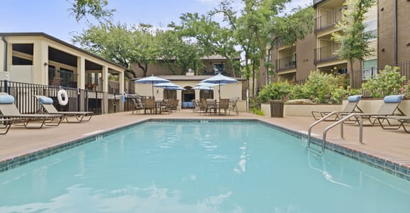
At The Creek, our one and two-bedroom apartments are spacious and modern. Residents live with convenient community amenities and the natural amenities brought by Brushy Creek.<\/p>\n
Live with direct access to Brushy Creek Regional Trail at The Creek apartments and experience ultimate convenience and peace in Round Rock.<\/p>\n","protected":false},"excerpt":{"rendered":"
The Brushy Creek regional trail is a testament to Williamson County’s dedication to providing accessible recreation to the area. The Creek apartments give direct access to Brushy Creek Regional Trail. Located in Round Rock near the Play for All Abilities Park, our residents enjoy jogging, biking, and walking along the trail all year long. […]<\/p>\n","protected":false},"author":31696,"featured_media":14,"comment_status":"closed","ping_status":"open","sticky":false,"template":"","format":"standard","meta":{"footnotes":""},"categories":[2],"tags":[],"class_list":["post-8","post","type-post","status-publish","format-standard","has-post-thumbnail","hentry","category-whats-nearby"],"metadata":{"_yoast_wpseo_metakeywords":[""],"es_title":[""],"es_content":[""],"_yoast_wpseo_title":["A Guide to Brushy Creek Regional Trail"],"_yoast_wpseo_metadesc":["This is our guide to Brushy Creek Regional Trail, including its history, what the path is like to hike and bike on, parking options, and notable highlights."],"_pingme":["1"],"_thumbnail_id":["14"]},"yoast_head":"\n
While the western Brushy Creek trail remains mostly on concrete, it passes through shaded wood away from the busy streets and without interruption to your hike or bike ride.<\/p>\n
This trailhead starts at Twin Lakes YMCA<\/a>, then underpasses Highway 183, cutting through the 183A Shared Use Path<\/a>, where it enters shaded wood along the water.<\/p>\n From the 183 highway, you’ll pass the Bob Ross and Rim Trail and the ¼ Notch Double Down trailhead, both narrow and heavily wooded dirt offshoots that make for excellent mountain biking.<\/p>\n Once you’ve ridden past Brushy Creek Sports Park<\/a>, home of athletic fields, a basketball court, a skate park, and disc golf, you’ll find yourself at Brushy Creek Lake Park on a dirt trail. Here, you’ll either travel near the water and loop back, or stick to the onward route. The reservoir is a quiet place for a picture or water break.<\/p>\n From Brushy Creek Lake Park<\/a>, you’ll take a short journey through a wooded granite trail until you reach Champion Park<\/a> where are more picnic tables and water fountains. <\/p>\n At Champion Park, there is more offshoot unpaved paths for mountain biking.<\/p>\n Here, the trail turns from concrete to crushed granite. You’ll head northeast toward Olson Meadows Park<\/a>, where there will be more amenities to take a rest.<\/p>\n Once past the park, you’ll travel on a dedicated path along Brushy Creek Road and Hairy Man Road until you reach the end<\/a> near Fern Bluff.<\/p>\n Since the western segment is longer than the eastern segment and includes a few dirt offshoots, specifically from Champion Park and the 183 highways, this portion of Brushy Creek Regional Trail is often preferred by cyclists.<\/p>\n East Brushy Creek Trail picks up at North Georgetown Street.<\/a> This path was recently developed with 10-foot-wide concrete trails, engineered for bikers, joggers, and walkers. While similar, this trail wider and more consistent than its western counterpart.<\/p>\n The beginning of this trail travels through wide, quiet green spaces surrounded by native plants, parallel to Brushy Creek and distant from road traffic.<\/p>\n You’ll ride through an underpass of A.W. Grimes Boulevard<\/a>, then tuck under a railroad near road traffic, though still on a dedicated and wide route. <\/p>\n Going east from A.W. Grimes, you’ll journey between a series of trees with several benches along the way, then find yourself at Rabb Park and the Play for All Abilities Park<\/a> where there are restrooms and water fountains, if needed.<\/p>\n From here, the route becomes more secluded, meaning its way through thick greenery before riding underneath South Kenney Fort Boulevard. Travel southward parallel to the road, then keep traveling eastward.<\/p>\n You’ll encounter a small boardwalk over the creek that is beautiful during sundown or sunset before voyaging through another series of tree thickets, wood, and crushed granite until reaching the end at Joe B Freeman Park<\/a>.<\/p>\n Brushy Creek Trail East is a nice trail whether on bike or on foot, though because of its wide, fully concrete paths and 3.75-mile distance, it is the perfect trail for a jog.<\/p>\n <\/p>\n Western segment<\/u><\/p>\n Other than the trailhead at Twin Lakes Park, here are a few notable stopping points: <\/p>\n Eastern segment<\/u><\/p>\n <\/p>\n Find parking along Brushy Creek Trail at these trail access points:<\/p>\n The best parking options for Brushy Creek Trail East is either at the Play for All Abilities Park or at the eastern end of the trail at Forrest Grove Park (outside Joe B Freeman Park)<\/p>\n <\/p>\n At The Creek, our one and two-bedroom apartments are spacious and modern. Residents live with convenient community amenities and the natural amenities brought by Brushy Creek.<\/p>\n Live with direct access to Brushy Creek Regional Trail at The Creek apartments and experience ultimate convenience and peace in Round Rock.<\/p>\n","protected":false},"excerpt":{"rendered":" The Brushy Creek regional trail is a testament to Williamson County’s dedication to providing accessible recreation to the area. The Creek apartments give direct access to Brushy Creek Regional Trail. Located in Round Rock near the Play for All Abilities Park, our residents enjoy jogging, biking, and walking along the trail all year long. […]<\/p>\n","protected":false},"author":31696,"featured_media":14,"comment_status":"closed","ping_status":"open","sticky":false,"template":"","format":"standard","meta":{"footnotes":""},"categories":[2],"tags":[],"class_list":["post-8","post","type-post","status-publish","format-standard","has-post-thumbnail","hentry","category-whats-nearby"],"metadata":{"_yoast_wpseo_metakeywords":[""],"es_title":[""],"es_content":[""],"_yoast_wpseo_title":["A Guide to Brushy Creek Regional Trail"],"_yoast_wpseo_metadesc":["This is our guide to Brushy Creek Regional Trail, including its history, what the path is like to hike and bike on, parking options, and notable highlights."],"_pingme":["1"],"_thumbnail_id":["14"]},"yoast_head":"\nThe Eastern Segment (N Georgetown St to Forest Bluff Playground)<\/h3>\n
\n
Highlights & Stopping Points<\/h2>\n
\n
\n
Where to Park<\/h2>\n
\n
\n
Live With Trail Access in Round Rock, TX<\/h2>\n